








By Our Reporter
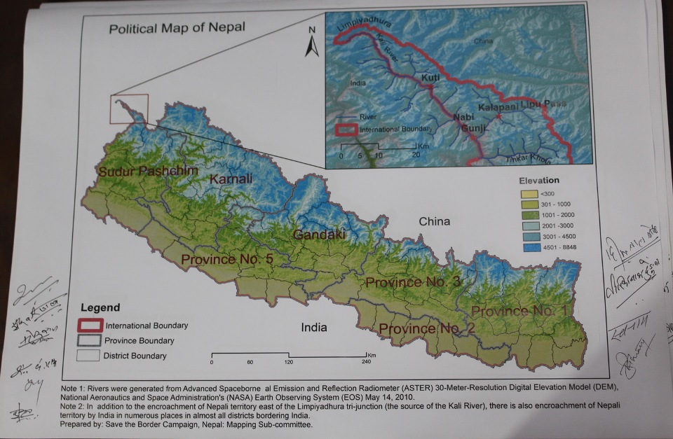
In a bid to exert pressure on the government to issue a new political map placing Limpiadhura, Lipub Lek and Kalapani inside Nepali territories, the civil society had unveiled a new political map of Nepal comprising these places in the Nepali soil.
Unveiling the map on Sunday, the civil society demanded the government to promptly publish the map depicting all the Nepali territories in Nepal that has so far been encroached by India.
“The map is based on digital elevation model,” said Dr NarendraKhanal, a member of the Border Protection Campaign.
Limpidhura is considered the origin of the Kali (Mahakali) river which demarcates the border between the two countries as mentioned in the Sugauli Treaty signed between the then East India Company and Nepal in 1816.
The civil society members came up with the new political map after India released a new political map placing Nepali territories Limpiadhura, Lipulekh and Kuring.
They urged the government to strongly oppose the Indian political map that placed Nepali territories Limpiadhura, Lipulekh and Kalapani inside its borders.
Former secretary Dr Dwarikanath Dhungel said that the political map prepared by the civil society members will be handed to the Nepal government soon.
Former Director General of Survey Department Punya Prasad Oli said that the Mahakali River is Nepal’s western border with India.

Login to add a comment