







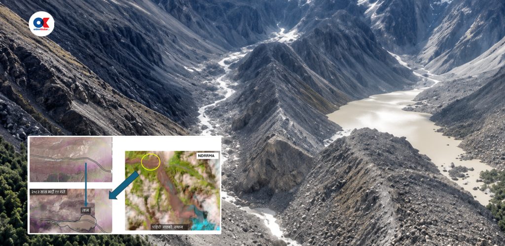
Kathmandu, Sept 2: The risk of further glacier collapses, debris flows and glacial lake outbursts remains in the area around Chochhen Khola, known as the Kuojian River in Chinese sources, after a devastating landslide and flood on August 26, China’s Ministry of Water Resources has said.
According to a report published by the Global Times on Tuesday, citing China Central Television, drone imagery taken at 8 am on September 1 showed that most of the water accumulated in the landslide-affected area had drained. River flow downstream had also returned to normal.
However, Chinese authorities warned that glaciers around the affected area could still collapse, potentially sending large volumes of debris into the river and creating new natural dams or glacial lakes.
China’s Ministry of Water Resources said it was continuing consultations, monitoring and risk assessments in Gyirong County of Tibet Autonomous Region, near Nepal’s border. Hydrological monitoring is also being carried out to support rescue and relief operations.
Satellite and radar analysis on August 31 showed that the water surface in the affected area had fallen to about 83,000 square metres, down 25,000 square metres from August 30 morning and 14,000 square metres from that evening. The area was estimated to have contained about 650,000 cubic metres of water.
Chinese researchers have warned that landslides could still block the river and create new lakes. Earlier drone surveys found several landslide deposits along both banks about three kilometres downstream from the former Purepu Changpo glacial lake.
China is also monitoring 14 moraine-dammed glacial lakes larger than 0.1 square kilometres in the Gyirong Changpo river basin. Ten have been classified as high risk and four as medium-to-low risk. However, no significant changes in their water levels have been detected over the past month.
A 14-member technical team deployed on August 31 has been conducting emergency hydrological monitoring of the Purepu Changpo, Donglin Changpo and Gyirong Changpo rivers.
At Gyirong Port, river discharge was measured at 125 cubic metres per second at 9 am on August 31. Chinese authorities said the data is being used for risk monitoring and early warning for rescue and relief teams downstream
People’s News Monitoring Service

Login to add a comment